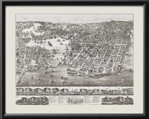
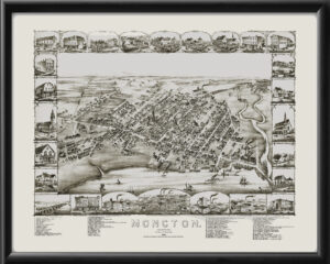
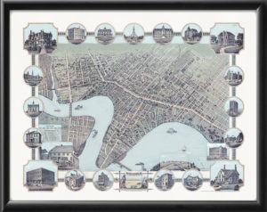
Restored bird’s eye view map of Toronto, Canada 1876 by Peter A. Gross. Features over 125 insets of factories, stores, churches, and schools. P. A. Gross walked every avenue, street, lane, and alley to produce this view of Toronto. He sketched every shop, dwelling, and factory in Toronto—14,000 private and public buildings in all—with “a faithfulness and a minuteness that excites astonishment and admiration in all beholders,†according to Illustrated Toronto (1877), a guidebook published to accompany the map.
Once completed, the individual images resulting from Gross’ painstaking survey of the city were stitched together to show the entire city from above. The original map was 3 feet x 5′, which is very close to our large size restoration of this map.